Friday, October 1, 2010

Umstead--Sycamore and Company Mill

Hike: Sycamore and Company Mill Circuit
Location: Umstead State Park
Nearby Town: Raleigh
Elevation (Max): 461'
Elevation Gained: 520'
Mileage: 10.85
Difficulty: Moderate
Trailhead: Enter the park from Glenwood Avenue (US-70) between Ebenezer Church Rd and Lumley Rd. Follow park road to the end and park. Trailhead is in picnic shelter area. Glenwood Ave. is accessible from I-540 Exit 4.
Web Site: http://www.ncparks.gov/Visit/parks/wium/main.php
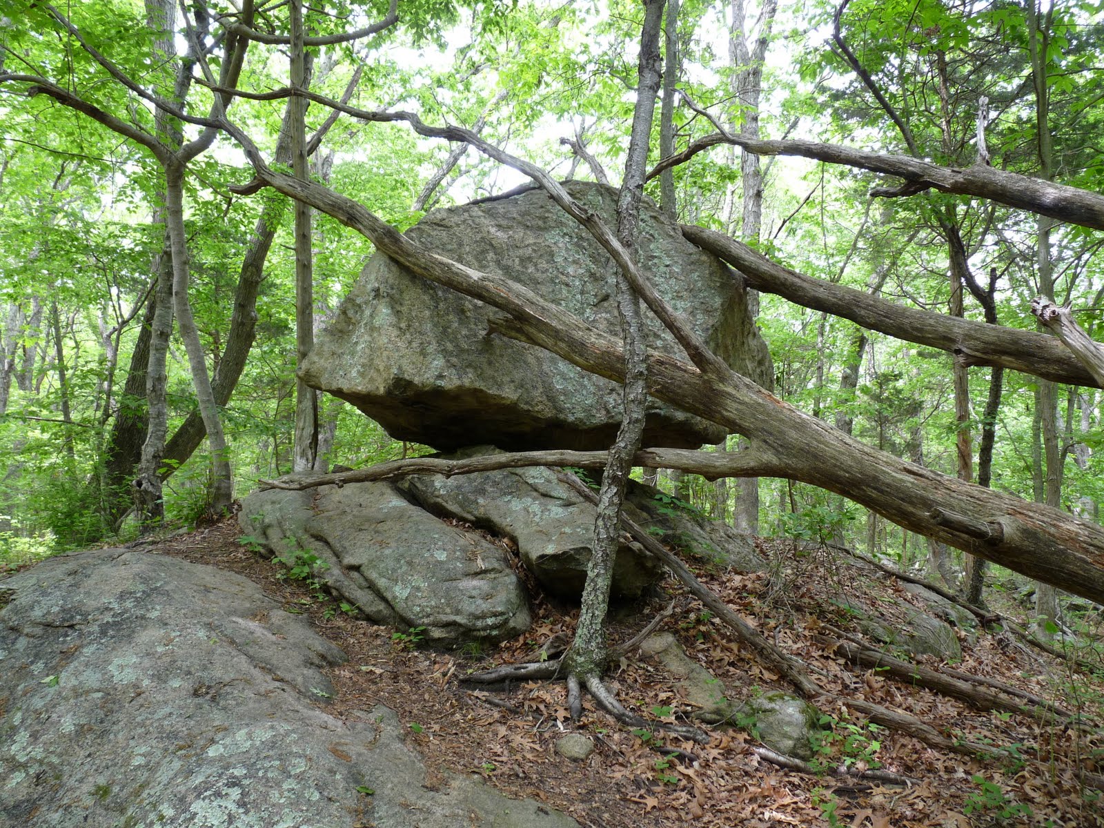
This lengthy circuit connects the two main trails of the north and south parts of the park. The trail is mostly flat with only a few steep, but short, hills. Most of the trail is dirt or pine needles, which makes for good trail running, but there are rocky sections, particularly on the hills. The Sycamore Trail and Company Mill Trail north of Reedy Creek Road are deep in the middle of the park so they are unlikely to be crowded. The Company Mill Trail along Crabtree Creek, however, is very popular, so you can expect to find some crowds there especially by the old dam. Some of the neat features of the hike are the towering loblolly pines, huge oaks, and fern-filled ravines. Wildlife, which is hard to come by in the Triangle, is easy to find on this hike. I saw 3 snakes (be careful of those on this hike--they like to hang out near the creeks), 2 deer, several fish (including one that ate a butterfly), a frog, and a great blue heron. Bring plenty of water if you are doing this hike in warmer months. Without long stops, the hike can be done in about 5 hours.

The beginning

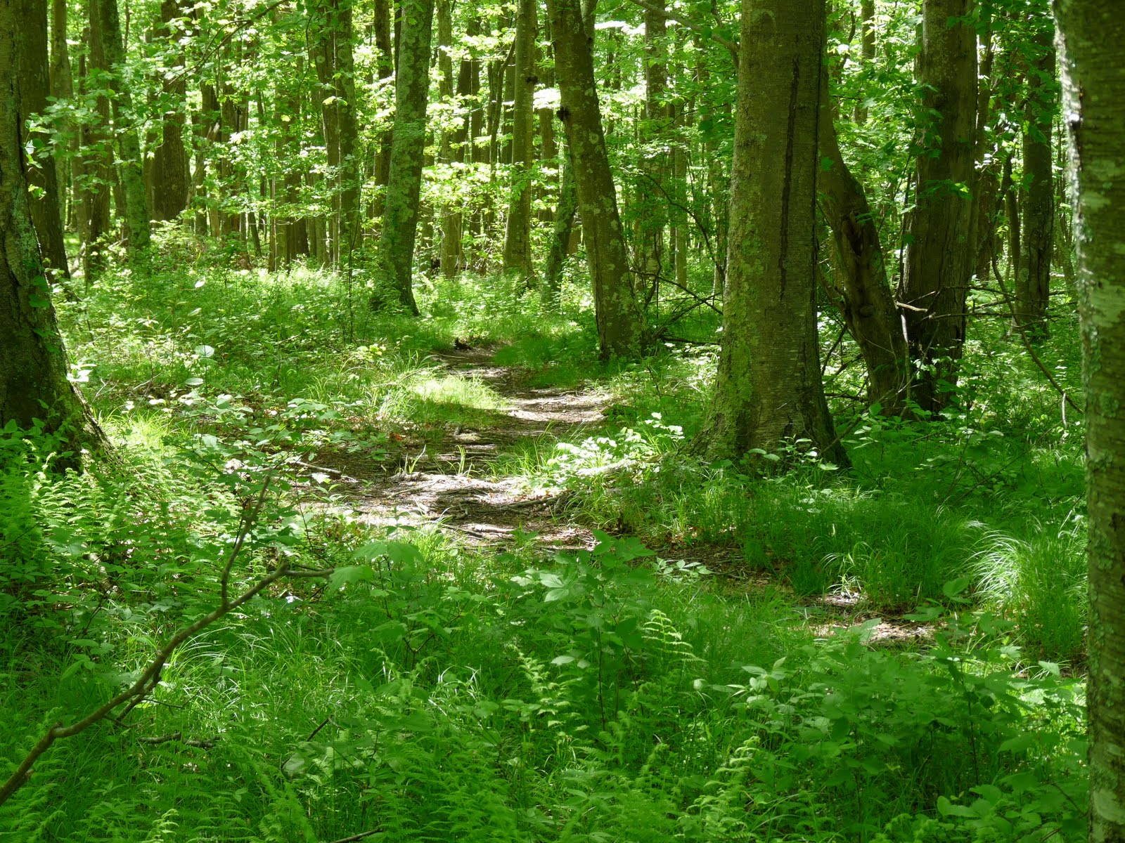
Begin the hike at the back of the picnic area next to Shelter 1. You will quickly come to a trail junction with clear signage to help you remain on the Sycamore Trail. Soon after the junction you will cross a small stream with a wooden bridge, and then turn left after crossing. After a little bit, the trail will come out onto a gravel road. Go left along the road, and you will find the continuation of the Sycamore Trail to the right just before the road crosses a bridge. This next section of the hike is very pleasant with soft trails and a small valley below. After going through this area, the trail turns right and walks along the edge of an open field. Continue onward for a while and you will come to another gravel road--go straight across it. The ground becomes a bit rockier in this section and there are some very large trees to admire. Eventually you will arrive at the beginning of the Sycamore Trail loop, so you can either way. I went left.

Crossing a small creek


Some big trees on this hike

You will soon cross yet another gravel road, and then continue on for a while until you reach a bridge crossing a stream. Turn right immediately after crossing to continue the loop and enter one of the coolest areas of the Sycamore Trail. The stream that you just crossed continues alongside the trail and makes a hard right hand turn in a deep ravine with a steep gully feeding into it at the stream's bend. In a little while the trail will meet up with Sycamore Creek (of which that stream in the ravine is a tributary) and parallel it for a while. There is a point where the creek takes a hard right turn and you can venture out onto large boulders in the creek to get uninterrupted views up and down the creek and also watch the surprisingly numerous fish swim around. I actually saw a fish eat a butterfly that was flying just above the surface--quite a big meal and something I've never seen before. As you continue on, if you are doing this hike in mid June, you might notice remarkable flowers scattered on the ground that have fallen from a tree above. These flowers, pictured below, were like nothing I had seen anywhere else (I would subsequently see them again while hiking at Eno, but there as well there was only one tree). The flowers are wispy and feathery; almost like hair with white bases and pink tips. They really reminded me of the Avatar.

The trail turning in a deep ravine


This steep ridge looks pretty impressive on such a flat hike
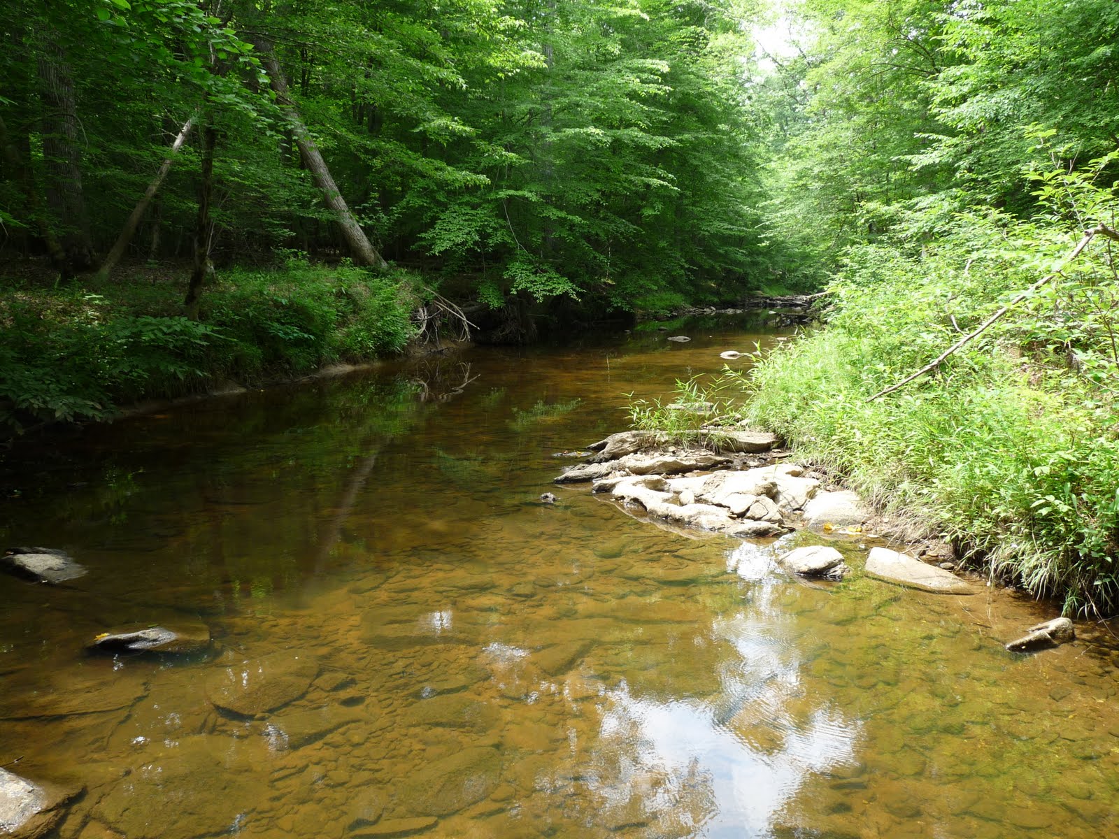
Sycamore Creek


Avatar flowers

Continue on, and the trail will cross under some power lines, take a right, and then meet a gravel road. At this point you have a couple options. First, you can continue to follow this circuit and cross the bridge to join up with the Company Mill Spur on the right. Second, if you aren't looking for an 11 mile hike, just cross the road (not the bridge) to continue the Sycamore Trail loop bringing you back to your car. The circuit will eventually return to this point and do exactly that, but only after adding on another 3.5 miles or so.

The Company Mill Spur is only .2 miles long so you will arrive at the Company Mill loop fairly quickly. Again, since this is a loop, you can go either way, but I chose to go right because I know from hiking the Company Mill Trail before that the trail on the left is a bit more interesting than the trail on the right and I like to save the interesting stuff for later to keep me motivated. Also, I wanted to make a big figure-8 pattern out of this hike. After a not all that remarkable hike through the northwest portion of the Company Mill Trail (one exception: there is an enormous tree that is probably the biggest living tree I've seen outside Yosemite), the trail meets up with Reedy Creek Road which is a multi-purpose road popular with bikers, equestrians, and runners and links the Black Creek Greenway in Cary to the Reedy Creek Greenway in Raleigh. Cross the road to tackle the southwest portion of the Company Mill loop. This is probably the most boring part of the hike with little variation in topography, geology, or vegetation. However, it leads to a reward: the most interesting part of the hike where the trail parallels Crabtree Creek.

Crabtree Creek

The trail takes a big left turn and meets up with Crabtree Creek along which the trail will run for a good while. The creek is pretty cool with very steep banks. I spotted a great blue heron down in the creek and tried to get some photos of it eventually scaring it away. Watching it fly down the creek between the steep banks felt like something out of Jurassic Park. The trail continues along the creek with steep, rocky hills and cliffs rising on your left when you come to the bridge that crosses the creek. Most visitors to the park, so far as I can tell, come down the trail that crosses the bridge to see the old Company Mill site on Crabtree Creek, so this area tends to be a little crowded. Some remnants of the Company Mill that you can see are the dam and a millstone. The creek flowing through the dam is one of the only places on Crabtree Creek where you can see some rapids, and there is a little beach and large, flat rocks from which to look at them.

Great blue heron going fishing

Breach in the old dam

Continue along the creek around a bend, and then the trail splits from the creek and heads north where the creek heads east. There are some more enormous trees to check out on the next part of the trail including one very wide loblolly. The trail then begins the most strenuous climb of the entire hike as it ascends a quartz-covered hill. The hill can be surprisingly exhausting given how short it is but after all the hiking done to this point on relatively flat ground, it doesn't take much steepness to be draining. Shortly after the hill, you will return to Reedy Creek Road which you should cross to complete the Company Mill loop. When you reach the Company Mill spur, take it to return to the gravel road from earlier, recross the bridge, and go left along the unexplored portion of the Sycamore trail.

Back on Sycamore Creek

This part of the Sycamore Trail follows the Sycamore Creek closely for a while before crossing under some power lines and gradually climbing up a large hill perched high above the creek. Near the top of the hill, you will have closed the Sycamore Loop returning to the point at which you turned left before. Stay straight, following the signs to return to the parking lot. Follow the trail retracing your steps to take you back to your car. Below is a GPS map of the hike.


Thursday, September 30, 2010

Jordan Lake--New Hope Overlook

Hike: New Hope Overlook
Location: Jordan Lake State Recreation Area
Nearby Town: Apex, NC
Elevation (Max): 400'
Elevation Gained: 575'
Mileage: 3
Difficulty: Easy
Trailhead: From Rte 64, go south on Beaver Creek Rd. Turn R onto Pea Ridge Road. Turn R on W H Jones Rd. Go past gatehouse, and immediately turn right to go to the parking lot.
Web Site: http://www.ncparks.gov/Visit/parks/jord/main.php

Jordan Lake is a great place to hike, boat, swim, fish, and camp during the warm months. There is a $6/car entrance fee from Memorial Day-Labor Day. Luckily, I got this hike in just before Memorial Day so I got in for free. Park in the lot immediately after the gatehouse on the right. The trailhead is at the near left corner when entering the parking lot. This hike is of the Blue Trail (3.03 mi), but could be extended to include the Red Trail (total 5.4 mi), which is just an extension of the Blue Trail Loop. The trail is obvious and clearly blazed. The ground is mostly dirt, some beds of pine needles, and occasionally could be wet if going after heavy rains or when the lake is high (it was completely dry for me, but I saw some coves where the trail looked like it gets submerged during periods of high water. The trail weaves into the forest and out to the coves, which provides a nice varied experience. Another attribute; unlike Umstead or even Eno, which draw the crowds, I encountered only one other person on this hike and that was at the trailhead; as I was returning a woman was heading onto the trail.


The first cove


Another view of the cove
Soon after beginning the hike, you will come to Y, which begins the loop. You can go either way, but I went right. The trail then winds through forest for a while going over small ups and downs before eventually coming to the first cove, which provides nice views and birdwatching opportunities. Continue onward around the cove until you come to a T. The loop continues to the left, but you should go right down the short Overlook Spur that leads to a very nice wide view of Jordan Lake (with a bench to rest!). After you've soaked in the view, return to the trail to continue the loop. The trail will cross a gravel road with the New Hope Overlook campsite to the right down the road--the site looks nice with pit toilets and private sites each with tent pads and accesses to the lake.

Big Jordan Lake view

Red Piedmont clay

Cross the road to continue the loop. The coves on this side of the peninsula are more secluded and quiet so the odds of seeing some wildlife here, especially bald eagles, are pretty good. Walk quietly and keep your eye on the lookout. The bald eagles seem especially fond of the loblolly pines (the tall pines with large segmented shaggy bark). At one of the coves the trail passes, I went off trail a bit to try to get a nice picture of the cove, and in so doing scared a bald eagle out of the trees. Sadly, I couldn't snap a picture of it before it was gone, but I waited for about 15 minutes in case it decided to return. It never did, but a great blue heron flew into the cove while I waited, but I ended up scaring that bird off as well when I tried to photograph it.

The cove where I saw the bald eagle and heron

Continue around the cove. When I went there was a pile of debris on the edge of the cove so it looks like this is an area that floods at high water. Continue onwards staying left at each of the two trail junctions ahead if you only want to do the Blue Trail. If you want to add in the Red Trail to put an extra 2.5 miles on the hike then go right on the Red Trail. The trail will then cross the same gravel road as before, and soon thereafter you will complete the loop finishing the hike. Below is a GPS map of the hike.

Wednesday, September 29, 2010

Rocky Neck

Hike: Rocky Neck Loop
Location: Rocky Neck State Park
Nearby Town: East Lyme, CT
Elevation (Max): 125'
Elevation Gained: 247'
Mileage: 2.9
Difficulty: Easy
Trailhead: Take Exit 72 off I-95 and head south on the Rocky Neck Connector. Turn L on Rte 156, then take the first right into the park. Stay on the park road to parking at the end. Walk to the pavilion overlooking the beach and walk over the train tracks on the bridge next to the pavilion.
Web Site: http://www.ct.gov/dep/cwp/view.asp?a=2716&q=325256

This is a fairly easy loop around the edges of Rocky Neck, which I did with my parents in early summer after enjoying a picnic at the large, stone, Depression-era pavilion. There is a fee to enter the park of between $6-$22 depending on weekday/weekend, resident/non-resident, after/before 4pm. Obviously, resident/weekday/after 4pm would be cheapest and non-resident/weekend/before 4pm would be most expensive. Rocky Neck has a color-coded trail system, and I would recommend printing out a map from the web site before going to the park.

Long Island Sound from the pavilion


The pavilion--a Depression project


This hike is the longest loop you can make in the park. You can either begin at the large stone pavilion or end there. We started there, crossed the train tracks, walked through an unused parking lot, along a paved road for a little while, then veered left into the woods on the Blue trail. Shortly thereafter, the Blue-Yellow trail breaks off the right to go to Backer's Cave surrounded by glacial erratics. The cave is a legitimate one tucked underneath a shelf formed by the rocks. I couldn't tell how deep it was, but it could make for interesting exploring. After checking this neat area out, we returned to the Blue-Yellow trail and continued onward to quickly rejoin the Blue Trail.

Small cliffs


Bakers Cave


The Trail has occasional views of Four Mile River below. The trail will join with the Red Trail briefly and split--at the split, go left on the Blue Trail. This will take you through Shipyard Field--an open grassy field. Be careful, though, there is a lot of poison ivy around. The Blue Trail then takes a sharp right as it approaches Rte 156, travels through a field, intersects with the Green Trail and Orange Trail, and then connects with the Red Trail. At this point switch onto the Red Trail, but the Red Trail also splits, so stay on the left branch to head toward Bride Brook.

Shipyard Field


Take the Red Trail to the Purple Trail, then the Purple Trail to the White Trail. Go right on the White Trail walking along the marsh of Bridge Brook. Remain on the White Trail until it intersects with the Red Trail where you should go left on the Red Trail to get back to the parking lot. Along the way, enjoy views of the marsh and ospreys, egrets, and herons. The trail crosses through open marsh at one point which provides nice views, and also the chance to watch fish and crabs in the water. Below is a GPS map of the hike.

Balancing rock


Tuesday, August 31, 2010

Bluff Point

Hike: Bluff Point--Mumford Cove
Location: Bluff Point State Park
Nearby Town: Groton, CT
Elevation (Max): 110'
Elevation Gained: 250'
Mileage: 5.35
Difficulty: Easy
Trailhead: From I-95, take Exit 88 and head south on Rte 117. Turn right at the T onto Rte 1 S. Turn left onto Depot Rd at the intersection with the Dairy Queen. Follow Depot Rd under a railroad bridge and into the park. Park anywhere in the large gravel lot. The trailhead is the main trail into the park with the large signboard with facts about the Coastal Reserve.
Web Site: http://www.ct.gov/dep/cwp/view.asp?A=2716&Q=325178

Bluff Point is probably the most popular park in southeastern Connecticut. It is a favorite of joggers, mountain bikers, hikers, picnickers, beach-goers, bird-watchers, and basically whatever else one does outdoors. Over July 4th weekend, I headed out there to map a hike for the blog and the Backpacker giveaway contest. There is a main double-track gravel trail that does a loop around most of the park, which is a popular hike or jog. I began on this track, breaking off to the left at the first Y to do the eastern portion of the loop first to get the hills out of the way in the first half and save the constant water views for the second half.

The east side of the main trail

One of many small side trails throughout the park

Follow signs to the Winthrop Homestead where you can see the foundation of what was John Winthrop's home (a Connecticut governor from the 1600s). Something that is often in the back of my mind when I'm hiking is an idea from the book "The World Without Us." The book is basically a thought experiment on what would happen if humans instantaneously disappeared from earth, and one thing the author suggests is that if this were to happen, the longest lasting remnants of our existence would be some of the oldest artifacts of our civilization--cave dwellings. This thought came to mind when I was observing the rock foundation of this home. I can't imagine it eroding away anytime soon--certainly no sooner than so many of our subdivisions built 350 years later. Another neat thing about this foundation is that when Winthrop built it, he could see the sea from his home. The sea is nowhere to be seen today due to the forest that has grown on Bluff Point.

The Winthrop foundation

But back to the hike. At the Winthrop Home, take a left to Mumford Cove. This trail is narrower and much less used. Follow to a Y where you should go left (you will take the right trail in a little bit) over some large, flat rocks. Then follow a small stream to the right down to Mumford Cove. After enjoying the sights of the cove from the rocks on the shore, return the way you came to the Y and go the only direction you have yet to explore. This part of the trail winds through forest with occasional views of Mumford Cove to the left. At some parts, the forest floor is completely covered with ferns. You will eventually come to a junction of small trails. Go right (the GPS track below shows me going left, but this was a mistake and I ended up backtracking to go right), and you will soon return to the main double-track trail. Go left on the trail. You will soon arrive at something called Sunset Rock, which is a decent sized boulder hidden amongst the trees. Believe it or not, this rock is so named because it was once a nice place from which to watch the sun set. With this new forest, that is certainly not the case.

Small stream down to Mumford Cove


Mumford Cove


Fern-covered forest floor

Continue along the main trail and you will eventually get beautiful, large ocean views. At this point you should start looking for a side trail off to the left that will take you to the top of Bluff Point's namesake bluff. There is a bench up here to rest and watch the boats come and go. I remember having a number of family picnics here when I was younger, and it is still a nice spot to come and sit. After getting your fill of the view, head north and you will find a trail that leads back to the main trail where you should turn left. If you want, you can go left to the beach. I also have many memories of this beach--my sisters and I liked to go to the bay side of the beach and catch hermit crabs. This hike skips the beach, though, and continues along the main trail back to the car. Below is a GPS-generated map of the hike.

Long Island Sound views


The bluff


Adventurous fishermen

<

Thursday, August 12, 2010

Guilford Courthouse

Hike: Guilford Courthouse
Location: Guilford Courthouse National Military Park
Nearby Town: Greensboro
Elevation (Max): N/A
Elevation Gained: N/A
Mileage: 1.8
Difficulty: Easy
Trailhead: From downtown Greensboro, take Rte 220 N (Battleground Ave) and then turn right on Old Battleground Road. Parking will be on the right. From the Triangle, take I-40 W. Then take Exit 227 to I-840 W and take Exit 18 onto US-70 W. Then turn R on Winstead Place, continue on W Northwood St, turn R at Battleground Ave, and then turn right onto Old Battleground Rd.
Web Site: http://www.nps.gov/guco/index.htm

I'm a bit of a history buff, so, as I mentioned in the previous post, E and I stopped at Guilford Courthouse Battlefield in Greensboro during our Piedmont Triad tour. This isn't so much a hike as it is a walk (albeit in the woods, which I have always used as the definition of a hike). Trails lead visitors around the battlefield to the many monuments scattered throughout the park and to key areas such as a creek the British charged across or the lines the American soldiers formed. Most of the trails are paved but some are loose gravel and they mostly go through woods with a few fields to cross as well. When the battle was fought here, more of the area was farmland, so the feeling one gets visiting is surely different from how it was for the soldiers on that day. And, in case you're wondering, the Americans (under the command of Nathaniel Greene) lost the battle, but, as seemed to happen so many times during the Revolutionary War, the victory was a Pyrrhic one for the British and only seven months later Cornwallis was besieged at Yorktown.

Park your car in the lot on Old Battleground Road, and cross the road to the visitor center where you can pick up a map of the park that also chronicles the battle. There are several paths that criss-cross throughout the park, and you can choose whichever you please, but E and I picked a route that took us around the majority of the park that worked pretty well. We began at the large monument of Nathaniel Greene mounted on his horse at the front of the park. From there, we went over to the monument to the North Carolinian signers of the Declaration of Independence.

Nathaniel Greene


Then we headed into the woods on the path to the left. This path, and most paths in the park, is windy and mostly flat with an occasional small hill. We crossed the first line the American troops formed and then came to a Y, where we turned left. Eventually we came to a T where we turned right up a hill that overlooks a field atop which is the Cavalry Monument. From this vantage point, one can begin to get a sense of what that day was like as you overlook the small field below. We continued on past the Cavalry Monument and took the path to the left. This trail will also split, we went right. The trail crosses New Garden Road (a gravel path) and continues on to a T. Go right here, cross a creek and you will soon be along the Americans' third, and last, line. There are replicas of the American six pound cannons nearby and the trail will lead to an automobile road. E and I walked along this a bit for any sign of Guilford Courthouse but we found none (the actual courthouse is long gone but we thought there might be a recreation or monument or something), so we turned around and walked along the side of the road until the New Garden Road split off.

Cavalry Monument overlooking a field


The replica cannons


We walked on this path back to the open field we saw earlier from the Cavalry Monument. There were pretty flowering trees in the field, but we decided to turn right on a trail just before the field. This path leads to the Regulars Monument and, after taking a left at a trail junction, the Maryland and Delaware Monuments. We then took a right along the New Garden Road again, passed the Caldwell Monument, and within no time we were back at Nathaniel Greene and our car. There is also a drive you can do around the park (note the auto road we walked along) with turnoffs at significant areas. Since this is a hiking blog, though, I would encourage you to get out and walk the battlefield just as the soldiers did in 1781.

Wednesday, July 28, 2010

Pilot Mountain

Hike: Pilot Mountain-Ledge Spring Trail
Location: Pilot Mountain State Park
Nearby Town: Pinnacle, NC (25 minutes north of Winston-Salem)
Elevation (Max): 2,200'
Elevation Gained: 440'
Mileage: 2.2
Difficulty: Moderate
Trailhead: From Winston-Salem: Take Route 52 N for 21 miles, take the Pilot Mountain Exit, turn left on Pilot Knob Park Road, turn left on Pilot Mountain Park Road and follow to the summit parking lot (you could park in the lot at the base and make the 4 mile hike up for a longer, more strenuous outing). Hit the trail from the southwest corner of the parking lot.
Web Site: http://www.ncparks.gov/Visit/parks/pimo/main.php

E and I decided to spend a day in the Triad region (as opposed to the Triangle, where we live, the Triad is made up of Winston-Salem, Greensboro, and High Point). We decided we would begin the day with a quick hike of Pilot Mountain which had been intriguing me since we saw its distinctive pinnacle on our Moore's Wall hike months earlier. The drive out to the mountain was pretty easy and the highway provided some nice head on views of the pinnacle.

When we got to the base of the mountain we were stopped next to the ranger residences and park office where we told the parking lot on the summit of Little Pinnacle was full so we could either drive up and wait or park at the base and hike up. Since we planned on making this a quick hike, we drove up. The road to the summit is narrow and windy with precipitous drops just off the road. We hit the line of traffic waiting to get to the summit lot with about a dozen cars ahead of us. Initially, we were discouraged, but cars left the summit lot at a fairly quick rate so we only waited about 15 minutes to get in.

Pilot Mountain


Pilot Mountain and some other Sauratown Peaks

We parked the car, left everything behind but my camera, and set out on the Ledge Spring Trail which essentially does a loop on and around the Little Pinnacle. Foolishly, we assumed a 2.2 mile hike would be easy enough that we could do without water--a regrettable decision. The trail begins with a moderately steep descent (always a worrying way to begin a hike) toward the Grindstone Trail (be careful, the trail initially leads to a picnic area, so pay attention to where the trail breaks off to the left). Once the trail reaches the junction with the Grindstone Trail, turn left to remain on the Ledge Spring loop, with the descent now mostly over.

Ledge Spring Trail after the Grindstone Junction

The second half of the hike is pretty impressive with towering cliffs constantly overhead on the left and views out to the flatland of the Piedmont to the right. This portion of the hike is also significantly more strenuous than the descent portion with lots of small ups and downs that really add up. This area is extremely popular with rock climbing and we encountered at least half a dozen groups of people attacking the cliffs. They were all pretty impressive and if I was a rock climber, I would definitely head out there often. About halfway through the cliffs portion, we really started to fade for lack of water. Anytime a breeze would blow up the mountain we paused and spread our arms like vultures airing out our wings to get whatever coolness we could. Finally, we arrived at a great view of the pinnacle of Pilot Mountain. I wanted to do the loop trail around the base of the pinnacle--no one is allowed on top of the pinnacle--but we were short on time if we were to fit in the rest of the day's activities so we turned left at the junction and returned to our car. We went on to enjoy donuts at the first Krispy Kreme, tour the Moravian village of Old Salem, and then walk the loop around Guilford Courthouse Battlefield in Greensboro. A good day in the Triad, indeed.

Cliffs on Ledge Spring Trail


More Cliffs

A cliff about to be climbed (see rope on left)


E and I at the end of the Ledge Spring Trail

Tuesday, July 20, 2010

Reedy Creek Greenway

Hike: Reedy Creek Greenway
Location: Capital Area Greenway
Nearby Town: Raleigh, NC
Elevation (Max): 480'
Elevation Gained: 220'
Mileage: 4.7
Difficulty: Easy
Trailhead: From I-40, take Exit 289 onto Raleigh Chapel Hill Expressway. Exit Raleigh Chapel Hill Expressway at the first exit onto Edwards Mill Road and turn L. Turn L on Reedy Creek Rd., then park on the first gravel road on the left.
Web Site: Raleigh Capital Area Greenway

One of the best things about the Triangle is its large and growing network of greenways for pedestrian and bicycle use. They are all over the place and increasingly becoming interconnected allowing cyclists to get around without facing off against traffic on four lane roads. This hike details an out and back on part of the Reedy Creek Greenway. Reedy Creek provides a good illustration of the interconnectedness of the greenways--one can go the 15 miles or so from Meredith College in Raleigh, by the North Carolina Museum of Art, along Reedy Creek Road, through Umstead State Park, onto Black Creek Greenway in Cary, which ends on Chapel Hill Road near downtown Cary with only a few brief segments on vehicular roads.

After getting out of the car you can go either way on Reedy Creek Greenway, which parallels Reedy Creek Rd. If you go left, you will arrive at Umstead State Park where the paved greenway transitions to a packed gravel road. For this walk, E and I chose to go right. First, though, we checked out the horses in the field beside the greenway. We stood next to the fence admiring the horses and the baby horses and watched as another couple a few feet away pet one of the horses across the fence. As I reached my arm across the fence to rub a horse's shoulder, my forearm touched a nylon string with an electrified wire weaved into it, and the shock was quite startling to me, but probably more so to the horse who took off running. So, the lesson here is don't pet the horses, or if you do, stay away from that wire.

The horses

Anyways, we walked along Reedy Creek Road on the greenway, occasionally stepping aside to allow cyclists to pass. When the greenway intersects Edwards Mill Road, you can either cross on the crosswalk or, to avoid the road, follow the greenway to the right through an underpass beneath Edwards Mill Rd. The next portion of the greenway is a sidewalk through an industrial sort of area--definitely not the highlight of the walk. Don't worry, though, it gets better. The road will intersect Blue Ridge Road, across which lies the North Carolina Museum of Art and its Museum Park. The greenway continues through the Art Park which features several outdoor pieces of art along with many side trails leading to other pieces of art. These trails are generally short and can be easily explored. The greenway then enters its most strenuous section with steep ups and downs eventually leading to a pedestrian bridge (the longest in North Carolina) that crosses I-440. E and I turned around here to return to the car for a 4.7 mile round trip. You could continue along the greenway, though, and follow it along the edge of Meredith College's campus to its terminus across from Ben and Jerry's on Hillsborough Street.

Wind Machine by Vollis Simpson


Gyre by Thomas Sayre


Pedestrian Bridge over I-440


To see Jennie smile by Steven Siegel (that thing is made entirely of newspapers)

Wednesday, June 23, 2010

Going to the Mountains!

(via Flickr)

I've been a bit negligent in updating the blog in the past couple weeks. I've been hiking like crazy, so I have plenty of material, but I've been occupied loading those hikes onto backpacker.com to participate in this contest. This weekend, E and I will be going on what I hope will be an amazing two-day hike on and around the Art Loeb Trail in the Shining Rock Wilderness in Pisgah National Forest. The hike starts at Graveyard Fields (where E and I hiked before; read about it here), climbs Black Balsam Knob, hikes along the Art Loeb Trail over a few balds, then turns around at Shining Rock, returning via the Ivestor Gap Trail and Graveyard Ridge Trail. Now, we just need to make sure we have good weather.

(via Flickr)


(via Flickr)

Monday, June 7, 2010

North Umstead Circuit

Hike: Sal's Branch/Pott's Branch Circuit
Location: Umstead State Park
Nearby Town: Raleigh, NC
Elevation (Max): 439'
Elevation Gained: ~270'
Mileage: 3.8
Difficulty: Easy
Trailhead: Enter the park off Glenwood Avenue (US-70) between Ebenezer Church Rd and Lumley Rd. Follow the paved park road to the end for parking. Glenwood Avenue is accessible from I-540.
Web Site: http://www.ncparks.gov/Visit/parks/wium/main.php

After going 4 months without taking a significant hike, I had some making up to do, so I did 3 hikes in 5 days for 14.3 miles. For this hike, I headed back to my old standby, Umstead, but for the first time, I went to the north portion of the park. This side of the park seems to have more amenities and activities such as a few campgrounds, a visitor center, several picnic shelters, and a lake with boat rentals. I planned to hike to Sal's Branch Trail (2.75 miles) loop, but after taking the short trail from the parking lot down to Big Lake, I decided I would explore Pott's Branch Trail too since it followed Sycamore Creek. So, I turned left onto Pott's Branch which parallels Sycamore Creek for a bit before turning left and rising above a smaller creek. When I went, the trails seemed to be undergoing some upkeep, and so they were rerouted away from their normal locations. Generally, I stayed left at junctions, which eventually returned me to the parking lot. I did not do all of Pott's Branch trail, but rather did the bottom half before taking the trail that cuts across the loop to the parking lot.

I walked across the parking lot again to the short trail down to Big Lake. This time, I turned right and walked along the lake a bit before the trail split to begin the loop. I looked at the map which seemed to indicate that the left branch of the loop followed the lake shore, and since I enjoy saving the highlights for the end of hikes, I went out on the right branch to save the views for the return. The hike out is pretty flat with only small ups and downs mostly in and out of erosion gullies. When I went, the ground was a bit soggy, but that probably would not be as much of a problem in warmer months. I encountered several other groups out enjoying the nice stretch of January weather, including some families, couples with their dogs, and what seemed like an introductory nature photography class.

The only confusing part of the trail I encountered was around the Visitor Center. The trail takes a hard right and then takes another right, but the map does not indicate any switchbacks like this, so I backtracked to make sure I didn't miss a trail. I couldn't find any trails, however, so I returned to the switchback and just decided to head for the Visitor Center since the map clearly shows the trail going curving toward it. This ended up working out as I quickly found the trail and continued onward past the Visitor Center and back into the woods. From the Visitor Center, it is a short jaunt to the end of the out branch where there is a trail junction with a spur to a campground. Keep left to finish the loop.

The return hike is very similar to the out hike, with maybe a few more hills (nothing serious, though). Unlike what the trail map seems to indicate, though, the return hike only provided views of the lake for the very end as I closed the loop--thick vegetation blocks the views for most of the return. After finishing the loop, just turn left on the trail on which you came down to return to your car. Sadly, I did not bring a camera on this hike, and I neglected to take any cell phone pictures so this post is visually lacking. The hike is a nice one, though, for an evening walk, and below is my GPS-generated route.

Thursday, June 3, 2010

Laurel Bluffs Trail

Hike: Laurel Bluffs Trail
Location: Eno River State Park
Nearby Town: Durham, NC
Elevation (Max): 385'
Elevation Gained: ~220'
Mileage: 5.3
Difficulty: Easy
Trailhead: From Raleigh: Take I-40 W Exit 279B onto 147 N. Take Exit 16A to 15/501 N. Take Exit 108D, turn L onto US-70 Business/Hillsborough Rd. Turn R on Cole Mill Rd, turn R onto Rivermont Rd (gravel road). Park in the gravel shoulder just over a small bridge. From Durham: Take 147 N and follow directions above. From the West (Hillsborough, Mebane, Burlington, Greensboro): Take I-85 N to Exit 170 onto US-70 Business East. Turn L on Sparger Rd, R onto Cole Mill Rd, then quick L onto Rivermont Rd.
Web Site: http://www.ncparks.gov/Visit/parks/enri/main.php

The day after my hike in South Umstead on the Company Mill/Reedy Creek/Loblolly Circuit, I decided to go out for another hike since it was still warm. This time I went back to Eno River State Park where, if you recall, E and I went on an underwhelming hike the previous summer. Everything I read about the Eno, though, talks it up quite a bit so I figured I would give it another try.

As I began the hike, it started to sprinkle, but it didn't seem like much to worry about so I went ahead anyway. The Laurel Bluffs Trail is an out and back hike that follows the Eno River to Guess Rd. before turning around. To begin, walk into the woods and follow the trail. A trail will go off to the left (the Pump Station Trail), which is a short loop so you can either take it or ignore it (I ignored it). Pretty soon after starting I came upon the remnants of what I guess was a mill as there was a broken dam and chimney along a tributary of the Eno. Not long after that I explored the eponymous pump station. This was pretty impressive--it was quite large and basically the foundation of a building made up of a bunch of compartments.

I returned to the trail and continued onward, eventually coming to what I believe was Bob's Hole, an area of the river where it widens and has rapids. The next prominent feature was Fish Dam Island, an island in the middle of the river in an area where the river makes an S-curve. I was pretty impressed by how evenly the water split around the island--it seems like, in my experience, rivers tend to prefer to go around an island one way or the other but this island split it 50-50. From the reunification of the river to the end of the trail at Guess Rd. there were not many more neat features.


A small tributary of the Eno

The trail goes through the largest ups and downs on the trail (but nothing major), crosses a few small streams that feed the Eno, and passes a breached dam. I reached Guess Rd., passed the only other people I saw on the entire hike--girls sneaking into the woods to smoke cigarettes, I'm going to go ahead and say they don't make the best life decisions--turned around and hiked quickly back to my car as the steady light drizzle that had been keeping me cool for the hike was now beginning to pick up. I took several pictures on my cell phone, but somehow I seem to have deleted all but one. This hike definitely redeemed Eno after the mediocrity of Bobbit Hole. The river is larger in this section and there are several more features such as the pump station, the remains of an old hunting lodge, and the dams to check out. I still have not made it out to the western portion of the park, which is far larger and has significantly higher terrain, so I anticipate my feelings about Eno will only continue to improve. Below is a GPS-generated track of the route.