
Location: Rocky Neck State Park
Nearby Town: East Lyme, CT
Elevation (Max): 125'
Elevation Gained: 247'
Mileage: 2.9
Difficulty: Easy
Trailhead: Take Exit 72 off I-95 and head south on the Rocky Neck Connector. Turn L on Rte 156, then take the first right into the park. Stay on the park road to parking at the end. Walk to the pavilion overlooking the beach and walk over the train tracks on the bridge next to the pavilion.
Web Site: http://www.ct.gov/dep/cwp/view.asp?a=2716&q=325256
This is a fairly easy loop around the edges of Rocky Neck, which I did with my parents in early summer after enjoying a picnic at the large, stone, Depression-era pavilion. There is a fee to enter the park of between $6-$22 depending on weekday/weekend, resident/non-resident, after/before 4pm. Obviously, resident/weekday/after 4pm would be cheapest and non-resident/weekend/before 4pm would be most expensive. Rocky Neck has a color-coded trail system, and I would recommend printing out a map from the web site before going to the park.
 Long Island Sound from the pavilion
 The pavilion--a Depression project
This hike is the longest loop you can make in the park. You can either begin at the large stone pavilion or end there. We started there, crossed the train tracks, walked through an unused parking lot, along a paved road for a little while, then veered left into the woods on the Blue trail. Shortly thereafter, the Blue-Yellow trail breaks off the right to go to Backer's Cave surrounded by glacial erratics. The cave is a legitimate one tucked underneath a shelf formed by the rocks. I couldn't tell how deep it was, but it could make for interesting exploring. After checking this neat area out, we returned to the Blue-Yellow trail and continued onward to quickly rejoin the Blue Trail.
 Small cliffs
 Bakers Cave
The Trail has occasional views of Four Mile River below. The trail will join with the Red Trail briefly and split--at the split, go left on the Blue Trail. This will take you through Shipyard Field--an open grassy field. Be careful, though, there is a lot of poison ivy around. The Blue Trail then takes a sharp right as it approaches Rte 156, travels through a field, intersects with the Green Trail and Orange Trail, and then connects with the Red Trail. At this point switch onto the Red Trail, but the Red Trail also splits, so stay on the left branch to head toward Bride Brook.
 Shipyard Field
Take the Red Trail to the Purple Trail, then the Purple Trail to the White Trail. Go right on the White Trail walking along the marsh of Bridge Brook. Remain on the White Trail until it intersects with the Red Trail where you should go left on the Red Trail to get back to the parking lot. Along the way, enjoy views of the marsh and ospreys, egrets, and herons. The trail crosses through open marsh at one point which provides nice views, and also the chance to watch fish and crabs in the water. Below is a GPS map of the hike.
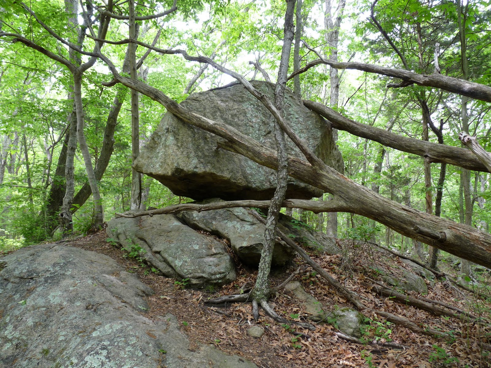 Balancing rock


Looks like a great hike! I haven't been to Rocky Neck in a while...
ReplyDelete