Wednesday, August 21, 2013

Blue Ridge Parkway--Green Knob

Hike: Green Knob Trail
Nearby Town: Blowing Rock, NC
Elevation (Max): 3900'
Elevation Gained: ~460'
Mileage: 2.1
Difficulty: Moderate
Trailhead: This hike is accessible from the Sim's Pond Overlook at Milepost 295.9 between the town of Blowing Rock and Grandfather Mountain
Web Site: http://www.blueridgeparkway.org/v.php?pg=61

Sim's Pond

E and I have made it a tradition to head west to the North Carolina mountains every year, usually in October.  Asheville is our usual home base for these trips, but a couple years ago, we decided to explore a new area, so we made out way out to Boone.  Turns out when people say Boone is the coolest place in North Carolina (thermally speaking), they aren't kidding.  E and I tried to save money by staying at a KOA instead of getting a room at a hotel.  Well, the morning we arrived at the KOA, they had an inch of snow on the ground...in October...in North Carolina.  The night we were to stay there, it was sleeting, with excessively high winds, so we went through about 8 fire starters without successfully roasting one s'more.  When we tried to go to sleep, I suffered a facial beating as the walls of our tent repeatedly collapsed on me as a result of the relentless winds.  At about 2 in the morning, I started browsing TripAdvisor on my phone and calling the local hotels to see if we could get a room anywhere, and it turned out that out of the 6 or so hotels in Boone, only one had a room available, and we packed up and headed for drier, warmer, and more peaceful sleep.  So much for saving money.


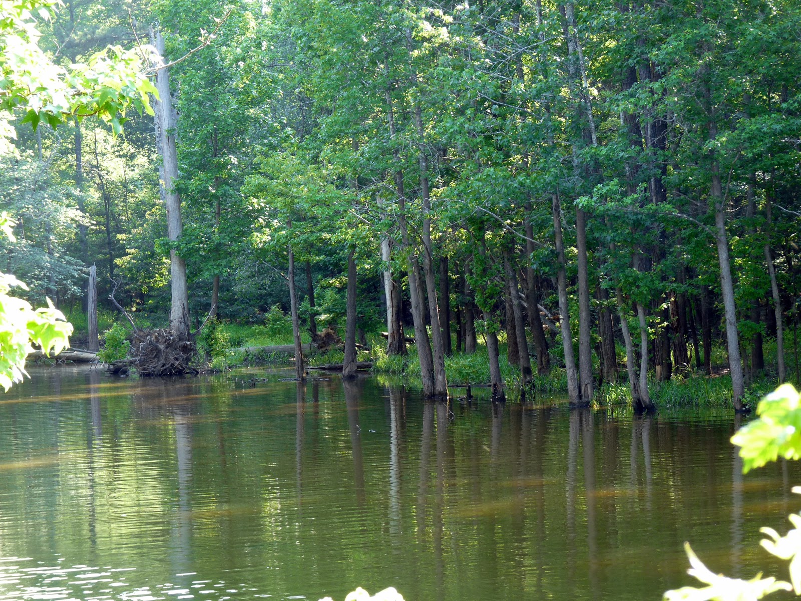
Now, on to the hike.  As you head south from the Blowing Rock area on the Blue Ridge Parkway between Moses Cone and Julian Price parks, you'll see a pull off at Sim's Pond at Milepost 295.9.  The pond is pretty small, but scenic, and there is a trail that crosses the spillway of the pond, and that is the beginning of this hike.  Once you get to the other side of the pond, turn left to head into a dense rhododendron forest.  The trail will go across a few small ups and downs crossing Sim's Creek a couple times.  Some of these stream crossings are easier than others, but none of them are hazardous and the trail is always pretty obvious.  After a little more than a half mile, the trail crosses beneath the Blue Ridge Parkway alongside Sim's Creek.  There is a trail that breaks off here to go to another overlook off the parkway, but ignore it and continue on the trail ahead to make a loop.


The trail continues along the creek for a little while longer before turning left and leaving the creek behind.  The trail also steepens at this point, but what's ahead is a great payoff for your efforts.  The trail sneaks through a narrow opening in a fence to enter a beautiful, hilly pasture.  On our hike, this section simply took our breath away.  There were cows grazing on the hillside with fall colors emerging in the trees lining the pasture.  Open spaces like this can sometimes make staying on a trail difficult, but there was a pretty obvious worn path when we went that made it very easy.


I just love how that one bright red tree stands out

As the trail continues its climb and heads back into the woods, you'll find a bench near an opening in the trees that gives a nice view of some of the mountain peaks beyond.  Continue on just a bit more, though, and the view really opens up as the trail enters a meadow filled with goldenrod.  Looming over the meadow in the distance is Grandfather Mountain.  The trail descends through the meadow, briefly passes through some woods, and drops you off on the Parkway.  Turn left on the road for a quick walk back to the Sim's Pond Overlook where the hike began.  There was something about hiking along that beautiful mountain creek and through a cow pasture in cool, misty weather that made this hike one of our favorites.  I highly recommend it.  Check out the GPS-generated map below.

Calloway Peak of Grandfather Mountain


Sunday, July 28, 2013

Eno Quarry

Hike: Eno Quarry
Nearby Town: Durham, NC
Elevation (Max): 496'
Elevation Gained: ~280'
Mileage: 2.28
Difficulty: Easy
Trailhead: From I-85, take Exit 173 and head south on Cole Mill Rd. Turn right on Hillsborough Rd/Rte 70.  Turn right on Sparger Rd, then turn left on Howe St and the parking for Cabe Lands (the section of Eno River State Park that contains this hike) will be on the right near a mobile home park.

From the Durham Freeway (Rte 147), take Exit 16A and then immediately take Exit 108D onto Hillsborough Rd (Rte 70).  Turn left and then follow the above instructions to Sparger Rd.

From 15/501, take Exit 108D and head west on Hillsborough Rd.  Then follow the above directions to Sparger Rd.
Web Site: http://ncparks.gov/Visit/parks/enri/main.php

I had heard about the Eno Quarry as a popular swimming hole during the summer, and I clearly have a penchant for hiking around anything with the name Eno, so I decided to check it out.  The trailhead is in a bit of an odd location down a residential street across from a mobile home park, but you quickly leave all that behind as you head down the trail towards the river.  There are two trails that can, and should, be connected in a circuit on this hike.


As you begin the hike on the first trail, you come to a junction where you can go straight or left.  You can really go either way because these trails are loops, but I decided to go straight and I returned on the trail to the left.  When I did this hike it was early spring, and it was an encouraging sight passing multiple patches on daffodils in bloom along the trail.  Just before reaching the river, the trail passes by the remains of the mill race of the Cabe Mill that used to sit along the banks of the Eno here.  The trail turns left along the Eno River and follows it for a bit, which is always enjoyable.  At some point, the trail turns away from the river and comes to a junction.  If you go left here, you get back to the parking lot (this is eventually the way you will return), but for now go right to get to Eno Quarry.

 Some mushrooms


Stream crossing

This is now the second trail that you can use to make a circuit.  There is a sign at this junction pointing you toward the Eno Quarry Trail.  The hike to the quarry is pretty quick and easy with one somewhat tricky stream crossing (the stream isn't dangerous or deep, but you do have to rock hop).  After the stream crossing, you've reached the loop around the four acre quarry.  You can go left or right along the high banks above the quarry.  This quarry was dug to provide material to build nearby I-85, and when it was abandoned it filled up with groundwater to make this pond.  Since it was a quarry, the pond is very deep and the banks drop off rapidly, so be careful around the edges.  There is one area along the northeast corner of the quarry where it looks like there was a ramp for trucks to get into and out of the quarry, so if there is anywhere that you can wade in that's probably it.  On the other side of the trail on the east side of the quarry is the Eno River as it travels below a hillside covered in some pretty serious boulders.  After doing the loop around the quarry, you can return the way you came, and when you reach the junction from earlier go right to return to the parking lot.  I already have a favorite swimming hole along the Eno that is much less deep, so I think I'd pass on joining in, but it would be interesting to come back during the summer to see how busy the quarry gets.  Check out the GPS-generated map below.


Thursday, January 17, 2013

Vista Point

Hike: Jordan Lake-Vista Point
Nearby Town: Apex/Pittsboro, NC
Elevation (Max): 247'
Elevation Gained: ~90'
Mileage: 3.01
Difficulty: Easy
Trailhead: Turn South onto North Pea Ridge Rd. from Route 64, a few miles west of Jordan Lake. Follow N. Pea Ridge Rd. to the parking lot at the boat launch at the end. Trailhead at near-left corner when entering the parking lot next to bathrooms.
Web Sitehttp://ncparks.gov/Visit/parks/jord/main.php

Jordan Lake
E and I enjoyed a relaxing loop hike in the Vista Point section of Jordan Lake in early summer.  The trailhead can be a bit difficult to find from the parking lot.  First find the bathrooms and follow the trail past it.  Then you will see a large picnic pavilion.  Walk through the pavilion to the trailhead on the other side.  This trail does not seem heavily used, and, at times, the trail is not obvious.  The beginning of the trail is one such area where there are a lot of small down trees and limbs.  The blazes are pretty well done, though, so despite this area, and a couple more areas where the trail is difficult to discern, you shouldn't get lost as long as you look for the blazes.  There are many short spur trails that go off the main trail to the lakeshore for nice views.


At the beginning of the hike, you will notice a campground on your left.  While the campground is still nearby, you will notice a spur off to the right that leads to a cove where we spotted a bald eagle perched in a tree across the water.  After enjoying the sight for a while, we returned to the trail and continued on the main trail which is relatively straight for a bit before taking a pretty sharp right hand turn.  Not long after the bend, there is a very short spur on the right that leads to a bench overlooking another little cove.  This spot is pretty secluded from the busier parts of the lake, and I would bet that if you just sat here for 15 minutes in the morning or evening, you would see some neat wildlife.

 
That would be a bald eagle


The trail then turns back into the woods for a while.  About halfway between the last lake lookout and the next one, the trail crosses a small wooden bridge over a gully.  Eventually you'll reach another spur trail on the right that leads to a much wider lake view.  The trail then parallels the shore of the peninsula fairly closely before arriving at the next lake view which includes a bench to relax at what is pretty close to the halfway point of the hike.


The trail then turns southwest to begin the back portion of the hike cutting through some woods.  There was a neat stand of some very tall but very skinny pines along this section of the hike.  A little later you'll arrive at another spur on the right that leads to a bench that appears to be used infrequently that overlooks one of the quietest coves on Jordan Lake.  I didn't see any wildlife when I visited, but I'm sure if you're patient you could see some neat stuff there.  This is the last water view of the hike.


Quiet cove

After returning to the main trail you begin to turn south before going southeast to close the loop.  There is a short, perhaps 20 yard section of trail as you approach the end that switches from the dirt/pine needle composition that you've been hiking on to knee high grass.  This sort of thing always makes me a bit nervous due to ticks, so we quickly high-stepped our way across.  Pretty soon after that, the trail meets the road on which you drove in, and you want to turn left and follow the road the rest of the way back to your car.  Check below for a GPS-generated map of the hike.


Monday, January 7, 2013

Jordan Lake--Seaforth

Hike: Seaforth
Nearby Town: Apex or Pittsboro, NC
Elevation (Max): 243'
Elevation Gained: ~50'
Mileage: 1.64
Difficulty: Easy
Trailhead: Turn south off US-64 into the Seaforth Recreation Area (there are roadside signs for it) in the Jordan Lake area.  There is a parking lot/boat launch pretty soon on the left, but continue on to the parking lot at the end of the road.  The trail leaves the parking lot on the west side (not the beach side).  I believe during the warm months, there is $6/car entrance fee.
Web Site: http://www.ncparks.gov/Visit/parks/jord/main.php

On a warm January day, E and I headed to Jordan Lake for a little hike.  Jordan Lake covers a pretty large area, and I've covered a different hike there before.  Any hike around Jordan Lake will be pretty flat and include some good open water views, and this one is no exception.  What this hike lacks a bit compared to other Jordan Lake hikes are secluded coves which herons and bald eagles tend to prefer, so the wildlife viewing on this hike wasn't as stellar as some others I've done before.

 Boardwalk near the beginning of the hike

The hike leaves the parking lot on the west side in the middle of the lot, and walks through some pine and deciduous forest.  In a short while, the views of the lake start to peek through the trees and the trail becomes a boardwalk to cope with the rising and lowering waters of the lake.  Just off the boardwalk, you can walk right to the lakeshore and take in the views.  Depending on the time of year, the lake could be extremely busy or very peaceful.  As one would assume, in January, when we went, it was the latter.

 Little cove

The hike then curves back into the forest, and skirts by a cove.  These little coves are one of the neatest parts of Jordan Lake.  If you are quiet, you can often spot some good wildlife in these areas, especially bald eagles, of which there is an abundance at Jordan Lake.  After the cove, the trail bends around the east side of a small pond, and cuts through more forest.  The trail then passes another pond on your right before coming out on the lake one last time on this side of the little peninsula that is Seaforth.

Typical Jordan Lake view

Easy path

Follow the trail east and then northeast, traversing a little meadow, and crossing the road you drove in on.  The trail then heads south for pretty much the rest of the way, eventually providing some lake views on the east side of the peninsula before ending at the beach/playground/beach volleyball/picnic area.  We were amazed how busy this place was in January, so I can only imagine how hopping it would be in the summer.  Overall, a really easy and relaxing hike with some good views to go with it.  Check out the GPS-generated map below!