
Nearby Town: Apex/Pittsboro, NC
Elevation (Max): 247'
Elevation Gained: ~90'
Mileage: 3.01
Difficulty: Easy
Trailhead: Turn South onto North Pea Ridge Rd. from Route 64, a few miles west of Jordan Lake. Follow N. Pea Ridge Rd. to the parking lot at the boat launch at the end. Trailhead at near-left corner when entering the parking lot next to bathrooms.
Web Site: http://ncparks.gov/Visit/parks/jord/main.php

Jordan Lake
E and I enjoyed a relaxing loop hike in the Vista Point section of Jordan Lake in early summer. The trailhead can be a bit difficult to find from the parking lot. First find the bathrooms and follow the trail past it. Then you will see a large picnic pavilion. Walk through the pavilion to the trailhead on the other side. This trail does not seem heavily used, and, at times, the trail is not obvious. The beginning of the trail is one such area where there are a lot of small down trees and limbs. The blazes are pretty well done, though, so despite this area, and a couple more areas where the trail is difficult to discern, you shouldn't get lost as long as you look for the blazes. There are many short spur trails that go off the main trail to the lakeshore for nice views.

At the beginning of the hike, you will notice a campground on your left. While the campground is still nearby, you will notice a spur off to the right that leads to a cove where we spotted a bald eagle perched in a tree across the water. After enjoying the sight for a while, we returned to the trail and continued on the main trail which is relatively straight for a bit before taking a pretty sharp right hand turn. Not long after the bend, there is a very short spur on the right that leads to a bench overlooking another little cove. This spot is pretty secluded from the busier parts of the lake, and I would bet that if you just sat here for 15 minutes in the morning or evening, you would see some neat wildlife.
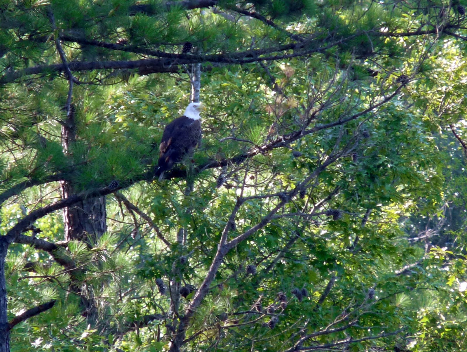
That would be a bald eagle

The trail then turns back into the woods for a while. About halfway between the last lake lookout and the next one, the trail crosses a small wooden bridge over a gully. Eventually you'll reach another spur trail on the right that leads to a much wider lake view. The trail then parallels the shore of the peninsula fairly closely before arriving at the next lake view which includes a bench to relax at what is pretty close to the halfway point of the hike.


The trail then turns southwest to begin the back portion of the hike cutting through some woods. There was a neat stand of some very tall but very skinny pines along this section of the hike. A little later you'll arrive at another spur on the right that leads to a bench that appears to be used infrequently that overlooks one of the quietest coves on Jordan Lake. I didn't see any wildlife when I visited, but I'm sure if you're patient you could see some neat stuff there. This is the last water view of the hike.

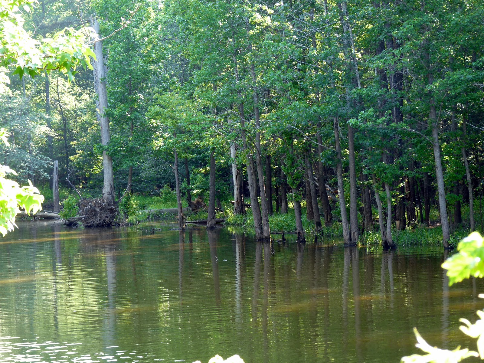
Quiet cove


Fun!
ReplyDelete