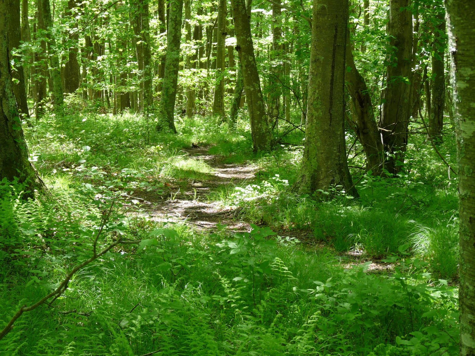
Hike: Bluff Point--Mumford Cove
Location: Bluff Point State Park
Nearby Town: Groton, CT
Elevation (Max): 110'
Elevation Gained: 250'
Mileage: 5.35
Difficulty: Easy
Trailhead: From I-95, take Exit 88 and head south on Rte 117. Turn right at the T onto Rte 1 S. Turn left onto Depot Rd at the intersection with the Dairy Queen. Follow Depot Rd under a railroad bridge and into the park. Park anywhere in the large gravel lot. The trailhead is the main trail into the park with the large signboard with facts about the Coastal Reserve.
Web Site: http://www.ct.gov/dep/cwp/view.asp?A=2716&Q=325178
Bluff Point is probably the most popular park in southeastern Connecticut. It is a favorite of joggers, mountain bikers, hikers, picnickers, beach-goers, bird-watchers, and basically whatever else one does outdoors. Over July 4th weekend, I headed out there to map a hike for the blog and the Backpacker giveaway contest. There is a main double-track gravel trail that does a loop around most of the park, which is a popular hike or jog. I began on this track, breaking off to the left at the first Y to do the eastern portion of the loop first to get the hills out of the way in the first half and save the constant water views for the second half.
Follow signs to the Winthrop Homestead where you can see the foundation of what was John Winthrop's home (a Connecticut governor from the 1600s). Something that is often in the back of my mind when I'm hiking is an idea from the book "The World Without Us." The book is basically a thought experiment on what would happen if humans instantaneously disappeared from earth, and one thing the author suggests is that if this were to happen, the longest lasting remnants of our existence would be some of the oldest artifacts of our civilization--cave dwellings. This thought came to mind when I was observing the rock foundation of this home. I can't imagine it eroding away anytime soon--certainly no sooner than so many of our subdivisions built 350 years later. Another neat thing about this foundation is that when Winthrop built it, he could see the sea from his home. The sea is nowhere to be seen today due to the forest that has grown on Bluff Point.
But back to the hike. At the Winthrop Home, take a left to Mumford Cove. This trail is narrower and much less used. Follow to a Y where you should go left (you will take the right trail in a little bit) over some large, flat rocks. Then follow a small stream to the right down to Mumford Cove. After enjoying the sights of the cove from the rocks on the shore, return the way you came to the Y and go the only direction you have yet to explore. This part of the trail winds through forest with occasional views of Mumford Cove to the left. At some parts, the forest floor is completely covered with ferns. You will eventually come to a junction of small trails. Go right (the GPS track below shows me going left, but this was a mistake and I ended up backtracking to go right), and you will soon return to the main double-track trail. Go left on the trail. You will soon arrive at something called Sunset Rock, which is a decent sized boulder hidden amongst the trees. Believe it or not, this rock is so named because it was once a nice place from which to watch the sun set. With this new forest, that is certainly not the case.
Continue along the main trail and you will eventually get beautiful, large ocean views. At this point you should start looking for a side trail off to the left that will take you to the top of Bluff Point's namesake bluff. There is a bench up here to rest and watch the boats come and go. I remember having a number of family picnics here when I was younger, and it is still a nice spot to come and sit. After getting your fill of the view, head north and you will find a trail that leads back to the main trail where you should turn left. If you want, you can go left to the beach. I also have many memories of this beach--my sisters and I liked to go to the bay side of the beach and catch hermit crabs. This hike skips the beach, though, and continues along the main trail back to the car. Below is a GPS-generated map of the hike.
<
Tuesday, August 31, 2010
Thursday, August 12, 2010
Guilford Courthouse
Hike: Guilford Courthouse
Location: Guilford Courthouse National Military Park
Nearby Town: Greensboro
Elevation (Max): N/A
Elevation Gained: N/A
Mileage: 1.8
Difficulty: Easy
Trailhead: From downtown Greensboro, take Rte 220 N (Battleground Ave) and then turn right on Old Battleground Road. Parking will be on the right. From the Triangle, take I-40 W. Then take Exit 227 to I-840 W and take Exit 18 onto US-70 W. Then turn R on Winstead Place, continue on W Northwood St, turn R at Battleground Ave, and then turn right onto Old Battleground Rd.
Web Site: http://www.nps.gov/guco/index.htm
I'm a bit of a history buff, so, as I mentioned in the previous post, E and I stopped at Guilford Courthouse Battlefield in Greensboro during our Piedmont Triad tour. This isn't so much a hike as it is a walk (albeit in the woods, which I have always used as the definition of a hike). Trails lead visitors around the battlefield to the many monuments scattered throughout the park and to key areas such as a creek the British charged across or the lines the American soldiers formed. Most of the trails are paved but some are loose gravel and they mostly go through woods with a few fields to cross as well. When the battle was fought here, more of the area was farmland, so the feeling one gets visiting is surely different from how it was for the soldiers on that day. And, in case you're wondering, the Americans (under the command of Nathaniel Greene) lost the battle, but, as seemed to happen so many times during the Revolutionary War, the victory was a Pyrrhic one for the British and only seven months later Cornwallis was besieged at Yorktown.
Park your car in the lot on Old Battleground Road, and cross the road to the visitor center where you can pick up a map of the park that also chronicles the battle. There are several paths that criss-cross throughout the park, and you can choose whichever you please, but E and I picked a route that took us around the majority of the park that worked pretty well. We began at the large monument of Nathaniel Greene mounted on his horse at the front of the park. From there, we went over to the monument to the North Carolinian signers of the Declaration of Independence.
Then we headed into the woods on the path to the left. This path, and most paths in the park, is windy and mostly flat with an occasional small hill. We crossed the first line the American troops formed and then came to a Y, where we turned left. Eventually we came to a T where we turned right up a hill that overlooks a field atop which is the Cavalry Monument. From this vantage point, one can begin to get a sense of what that day was like as you overlook the small field below. We continued on past the Cavalry Monument and took the path to the left. This trail will also split, we went right. The trail crosses New Garden Road (a gravel path) and continues on to a T. Go right here, cross a creek and you will soon be along the Americans' third, and last, line. There are replicas of the American six pound cannons nearby and the trail will lead to an automobile road. E and I walked along this a bit for any sign of Guilford Courthouse but we found none (the actual courthouse is long gone but we thought there might be a recreation or monument or something), so we turned around and walked along the side of the road until the New Garden Road split off.
We walked on this path back to the open field we saw earlier from the Cavalry Monument. There were pretty flowering trees in the field, but we decided to turn right on a trail just before the field. This path leads to the Regulars Monument and, after taking a left at a trail junction, the Maryland and Delaware Monuments. We then took a right along the New Garden Road again, passed the Caldwell Monument, and within no time we were back at Nathaniel Greene and our car. There is also a drive you can do around the park (note the auto road we walked along) with turnoffs at significant areas. Since this is a hiking blog, though, I would encourage you to get out and walk the battlefield just as the soldiers did in 1781.
Location: Guilford Courthouse National Military Park
Nearby Town: Greensboro
Elevation (Max): N/A
Elevation Gained: N/A
Mileage: 1.8
Difficulty: Easy
Trailhead: From downtown Greensboro, take Rte 220 N (Battleground Ave) and then turn right on Old Battleground Road. Parking will be on the right. From the Triangle, take I-40 W. Then take Exit 227 to I-840 W and take Exit 18 onto US-70 W. Then turn R on Winstead Place, continue on W Northwood St, turn R at Battleground Ave, and then turn right onto Old Battleground Rd.
Web Site: http://www.nps.gov/guco/index.htm
I'm a bit of a history buff, so, as I mentioned in the previous post, E and I stopped at Guilford Courthouse Battlefield in Greensboro during our Piedmont Triad tour. This isn't so much a hike as it is a walk (albeit in the woods, which I have always used as the definition of a hike). Trails lead visitors around the battlefield to the many monuments scattered throughout the park and to key areas such as a creek the British charged across or the lines the American soldiers formed. Most of the trails are paved but some are loose gravel and they mostly go through woods with a few fields to cross as well. When the battle was fought here, more of the area was farmland, so the feeling one gets visiting is surely different from how it was for the soldiers on that day. And, in case you're wondering, the Americans (under the command of Nathaniel Greene) lost the battle, but, as seemed to happen so many times during the Revolutionary War, the victory was a Pyrrhic one for the British and only seven months later Cornwallis was besieged at Yorktown.
Park your car in the lot on Old Battleground Road, and cross the road to the visitor center where you can pick up a map of the park that also chronicles the battle. There are several paths that criss-cross throughout the park, and you can choose whichever you please, but E and I picked a route that took us around the majority of the park that worked pretty well. We began at the large monument of Nathaniel Greene mounted on his horse at the front of the park. From there, we went over to the monument to the North Carolinian signers of the Declaration of Independence.
Then we headed into the woods on the path to the left. This path, and most paths in the park, is windy and mostly flat with an occasional small hill. We crossed the first line the American troops formed and then came to a Y, where we turned left. Eventually we came to a T where we turned right up a hill that overlooks a field atop which is the Cavalry Monument. From this vantage point, one can begin to get a sense of what that day was like as you overlook the small field below. We continued on past the Cavalry Monument and took the path to the left. This trail will also split, we went right. The trail crosses New Garden Road (a gravel path) and continues on to a T. Go right here, cross a creek and you will soon be along the Americans' third, and last, line. There are replicas of the American six pound cannons nearby and the trail will lead to an automobile road. E and I walked along this a bit for any sign of Guilford Courthouse but we found none (the actual courthouse is long gone but we thought there might be a recreation or monument or something), so we turned around and walked along the side of the road until the New Garden Road split off.
We walked on this path back to the open field we saw earlier from the Cavalry Monument. There were pretty flowering trees in the field, but we decided to turn right on a trail just before the field. This path leads to the Regulars Monument and, after taking a left at a trail junction, the Maryland and Delaware Monuments. We then took a right along the New Garden Road again, passed the Caldwell Monument, and within no time we were back at Nathaniel Greene and our car. There is also a drive you can do around the park (note the auto road we walked along) with turnoffs at significant areas. Since this is a hiking blog, though, I would encourage you to get out and walk the battlefield just as the soldiers did in 1781.
Wednesday, July 28, 2010
Pilot Mountain
Hike: Pilot Mountain-Ledge Spring Trail
Location: Pilot Mountain State Park
Nearby Town: Pinnacle, NC (25 minutes north of Winston-Salem)
Elevation (Max): 2,200'
Elevation Gained: 440'
Mileage: 2.2
Difficulty: Moderate
Trailhead: From Winston-Salem: Take Route 52 N for 21 miles, take the Pilot Mountain Exit, turn left on Pilot Knob Park Road, turn left on Pilot Mountain Park Road and follow to the summit parking lot (you could park in the lot at the base and make the 4 mile hike up for a longer, more strenuous outing). Hit the trail from the southwest corner of the parking lot.
Web Site: http://www.ncparks.gov/Visit/parks/pimo/main.php
E and I decided to spend a day in the Triad region (as opposed to the Triangle, where we live, the Triad is made up of Winston-Salem, Greensboro, and High Point). We decided we would begin the day with a quick hike of Pilot Mountain which had been intriguing me since we saw its distinctive pinnacle on our Moore's Wall hike months earlier. The drive out to the mountain was pretty easy and the highway provided some nice head on views of the pinnacle.
When we got to the base of the mountain we were stopped next to the ranger residences and park office where we told the parking lot on the summit of Little Pinnacle was full so we could either drive up and wait or park at the base and hike up. Since we planned on making this a quick hike, we drove up. The road to the summit is narrow and windy with precipitous drops just off the road. We hit the line of traffic waiting to get to the summit lot with about a dozen cars ahead of us. Initially, we were discouraged, but cars left the summit lot at a fairly quick rate so we only waited about 15 minutes to get in.
We parked the car, left everything behind but my camera, and set out on the Ledge Spring Trail which essentially does a loop on and around the Little Pinnacle. Foolishly, we assumed a 2.2 mile hike would be easy enough that we could do without water--a regrettable decision. The trail begins with a moderately steep descent (always a worrying way to begin a hike) toward the Grindstone Trail (be careful, the trail initially leads to a picnic area, so pay attention to where the trail breaks off to the left). Once the trail reaches the junction with the Grindstone Trail, turn left to remain on the Ledge Spring loop, with the descent now mostly over.
The second half of the hike is pretty impressive with towering cliffs constantly overhead on the left and views out to the flatland of the Piedmont to the right. This portion of the hike is also significantly more strenuous than the descent portion with lots of small ups and downs that really add up. This area is extremely popular with rock climbing and we encountered at least half a dozen groups of people attacking the cliffs. They were all pretty impressive and if I was a rock climber, I would definitely head out there often. About halfway through the cliffs portion, we really started to fade for lack of water. Anytime a breeze would blow up the mountain we paused and spread our arms like vultures airing out our wings to get whatever coolness we could. Finally, we arrived at a great view of the pinnacle of Pilot Mountain. I wanted to do the loop trail around the base of the pinnacle--no one is allowed on top of the pinnacle--but we were short on time if we were to fit in the rest of the day's activities so we turned left at the junction and returned to our car. We went on to enjoy donuts at the first Krispy Kreme, tour the Moravian village of Old Salem, and then walk the loop around Guilford Courthouse Battlefield in Greensboro. A good day in the Triad, indeed.
Location: Pilot Mountain State Park
Nearby Town: Pinnacle, NC (25 minutes north of Winston-Salem)
Elevation (Max): 2,200'
Elevation Gained: 440'
Mileage: 2.2
Difficulty: Moderate
Trailhead: From Winston-Salem: Take Route 52 N for 21 miles, take the Pilot Mountain Exit, turn left on Pilot Knob Park Road, turn left on Pilot Mountain Park Road and follow to the summit parking lot (you could park in the lot at the base and make the 4 mile hike up for a longer, more strenuous outing). Hit the trail from the southwest corner of the parking lot.
Web Site: http://www.ncparks.gov/Visit/parks/pimo/main.php
E and I decided to spend a day in the Triad region (as opposed to the Triangle, where we live, the Triad is made up of Winston-Salem, Greensboro, and High Point). We decided we would begin the day with a quick hike of Pilot Mountain which had been intriguing me since we saw its distinctive pinnacle on our Moore's Wall hike months earlier. The drive out to the mountain was pretty easy and the highway provided some nice head on views of the pinnacle.
When we got to the base of the mountain we were stopped next to the ranger residences and park office where we told the parking lot on the summit of Little Pinnacle was full so we could either drive up and wait or park at the base and hike up. Since we planned on making this a quick hike, we drove up. The road to the summit is narrow and windy with precipitous drops just off the road. We hit the line of traffic waiting to get to the summit lot with about a dozen cars ahead of us. Initially, we were discouraged, but cars left the summit lot at a fairly quick rate so we only waited about 15 minutes to get in.
We parked the car, left everything behind but my camera, and set out on the Ledge Spring Trail which essentially does a loop on and around the Little Pinnacle. Foolishly, we assumed a 2.2 mile hike would be easy enough that we could do without water--a regrettable decision. The trail begins with a moderately steep descent (always a worrying way to begin a hike) toward the Grindstone Trail (be careful, the trail initially leads to a picnic area, so pay attention to where the trail breaks off to the left). Once the trail reaches the junction with the Grindstone Trail, turn left to remain on the Ledge Spring loop, with the descent now mostly over.
The second half of the hike is pretty impressive with towering cliffs constantly overhead on the left and views out to the flatland of the Piedmont to the right. This portion of the hike is also significantly more strenuous than the descent portion with lots of small ups and downs that really add up. This area is extremely popular with rock climbing and we encountered at least half a dozen groups of people attacking the cliffs. They were all pretty impressive and if I was a rock climber, I would definitely head out there often. About halfway through the cliffs portion, we really started to fade for lack of water. Anytime a breeze would blow up the mountain we paused and spread our arms like vultures airing out our wings to get whatever coolness we could. Finally, we arrived at a great view of the pinnacle of Pilot Mountain. I wanted to do the loop trail around the base of the pinnacle--no one is allowed on top of the pinnacle--but we were short on time if we were to fit in the rest of the day's activities so we turned left at the junction and returned to our car. We went on to enjoy donuts at the first Krispy Kreme, tour the Moravian village of Old Salem, and then walk the loop around Guilford Courthouse Battlefield in Greensboro. A good day in the Triad, indeed.
Subscribe to:
Posts (Atom)